|
In April 2002, we arrived in Santa Teresa at the northern tip of Sardinia by a ferry from Bonifacio, Corsica, after a brief 50 minute trip. This is the first time either of us has been to Sardinia and we are not sure what we will see. The first thing we noticed upon our arrival is that there is a fair amount of new construction. This was interesting considering there was very little new construction that we saw in Corsica.
Our first stop was at local shops in search of a map of the island and a tour book written in English (neither of us knows any Italian). Having completed this assignment we found a cafe/bar for a sandwich and a drink. Then we located a place to stay in order to start working on this page and read the tour book so we could plan our trip through the island.
|
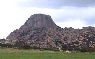
The next morning we left Santa Teresa and headed south through the town of Tempo and Oschiri to see some granite rock deposits. At one point we thought we were having a close encounter of a different kind when we passed the rock formation pictured below. While not at tall as Devil’s Tower located in the state of Wyoming in the US it sure does bear a strong resemblance.
|
|
|
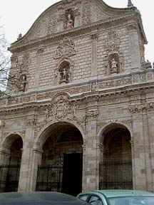
We finished our day in Sassari because the weather was turning increasingly bleak - it started to rain just as we arrived in the town. Sassari is the second largest city in Sardinia with a population around 130,000 people. After we found a place to stay we did a bit of a walk about to see what the town had to offer. We could not locate a map of the town anywhere but were able to find our location on the small map in our tour book of Sardinia. Above right is the front of the cathedral of Saint Nicola of Bari located in the Piazza Duomo. The tour book describes the front of the cathedral as a, “spectacular baroque facade”.
We also walked through the old center of town with its narrow, irregular streets, the Giardino Pubblico, and the local university. We really got lucky when we found a book store near the university that had quite an extensive stock of English language novels. So we each found a paperback book - we had finished our last ones while waiting for Verna’s bike to be repaired in Ajaccio, Corsica.
Having had enough of the big city, we headed out to the countryside the next day, first north toward Porto Torres where we rode along the beach (except that you couldn’t see it for all the pine woods between us and the water). Here we noticed several young African women standing along the side of the road, trying to catch the interest of passing drivers. Hmm, wonder what they were up to???
|
|
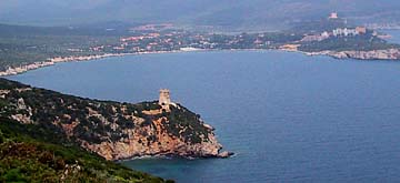
We skirted around Porto Torres so didn’t see much of the town then headed southeast toward Porto Conte. This area is fairly flat with lots of agriculture and is lightly populated. The coast near Porto Conte provides some interesting panoramas of the bay (left). In the photo you can see a tower on the point. These towers circle the island and most of them were erected in the 17th century when Sardinia was under Spanish rule. If you drive all the way to the end, there is access to Neptune’s Grotto, a deep cave at sea level with many rooms full of stalagmites and stalagtites.
|
|
|
|
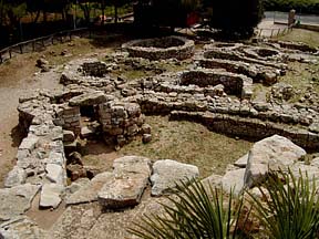
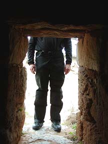
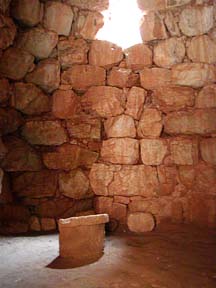
Between Porto Conte and Alghero there are some Nuraghic ruins we visited. There are several sites such as this over the island, all of them dating between 1500 and 500 BC. This one at Palmavera still retains the original towers (dated to 1500 BC and portions of many of the surrounding huts added later (12th to 10th centuries BC). The photo at right is from inside the main tower. As you can see, the tower is made of dry-set stone, formed in a circle with a dome top. It is guessed that these towers were used for religious purposes. At left is Jim entering the tower through the small doorway (be sure to duck!).
|
|
|
|
At right, the remains of some of the huts that made up the village are viewed from on top of the tower. There were over 50 huts in the village as well as a large meeting hall. We were very impressed with the architectural and construction capabilities from so long ago.
That evening we stayed in the town of Alghero, the largest town in the area. We found we can only find hotels in these larger towns especially at this time of year. It appears the tourist season on Sardinia is limited to just a few summer months and many hotels close down for the rest of the year.
|
|
|
The picture above is of the port and city of Alghero. The town retains many of the Spanish towers, but much of the original wall (still visible at far right) has been torn down to allow for the expansion of the city. We walked up and down the narrow cobbled streets, admiring the shops and handicrafts. There is a lot of jewelry made from coral here, and some of it is quite exquisitely carved. We also found it interesting that in most of the jewelry shops, the jeweler has his workbench set up near the back of the shop in full view so you can see them at work. What we found to be missing, however, were reasonably-priced restaurants. There were a couple of very nice restaurants with expensive menus (full menus were over 20 Euro), and one or two pannini/pizzeria shops and lots of cafes and gelaterias.
|
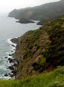
We liked the are so much we spent two days in Alghero. When we left, we rode the coast road from Alghero to Bosa which reminded us a lot of Highway 1 in California. Unfortunately, the weather was quite overcast so much of the drama was missing. In fact, once we climbed above 600 feet, we were in the clouds and had no view. However, we were able to get one or two views of the rugged coastline (right) before reaching Bosa.
|
|
|
Bosa was not a stopping point for us, but we thought we would take the scenic tour through town to get a glimpse of it. Getting in was easy enough, but we thought we would never get out! We now have quite a lot of street detail on our GPS from our bread crumb trails. They were doing some roadwork and had the main thoroughfare closed off, with no diversion signs.
Some of the old roads in town were paved with two rows of large flat stones for the wheel tracks and round stones for the rest, which made interesting riding on the motorbikes (the flat stones were so smooth and slick from the rain that it was difficult staying on them, and the round stones were quite uneven and bumpy).
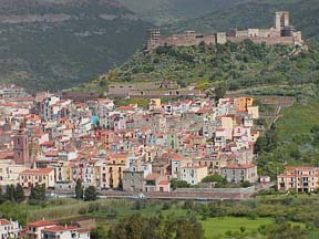
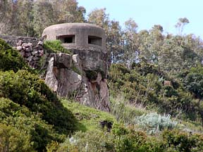
We went back to the main road and drove around town rising above it into the hills as we continued our journey south. From up on the hill, we got a birds-eye view of the town (above, left). While we were stopped, we noticed there were also a few relics left over from the W.W.II era. This small bunker (above, right) was overlooking the road we were on, while another larger one sat near the road, overlooking the town.
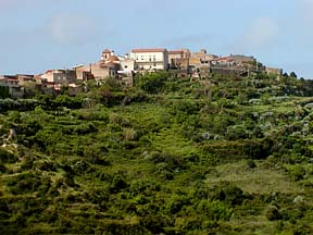
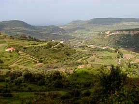
Continuing south, the road zigzags through the hills, heading inland toward Cuglieri. On the way, we passed through the small hilltop town of Magomadas (above, left). From here we got a good view of the surrounding fertile valleys (above, right) looking out toward the sea.
We stopped for lunch in Oristano, since it was the first town we found that had any indications of restaurants. However, once in town, we drove around for quite a long time before finally finding a restaurant that was open. After eating, we headed to the coast to find a hotel, but again, no luck. So it was back to Oristano. Even then, the only way we found the hotel was by using the GPS as it had several in its database. We never did see one sign for a hotel! We don’t think Sardinia is set up for the independent traveler (at least out of season).
|
From Oristano, we headed south on the main highway to Cagliari. Most of the way the land was flat and the road was straight (except for the numerous curves as we turned on and off the portions of the road being worked on). This area of Sardinia is definitely the breadbasket of the island as we passed acres and acres of wheat. The mountains were visible to us on the left for the first 50 kilometers, while it appeared to be relatively flat all the way to the sea on the right. We started down the west side of the bay from Cagliari, but soon turned around as it quickly became very industrialized with tall stacks belching out smoke. We then tried the east side of the bay and were much more pleased. Just outside the town, however, we came upon the beach area of Poetto, which appeared to be where all the Calgiaris go on a Sunday afternoon. The place was packed with people strolling around and we were lucky to find a restaurant - Chinese for a change. It was good, but the first time we had lemon chicken without a sauce on it (it was served with a lemon half).
|
|
|
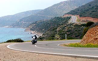
Heading further out, we quickly entered the land of holiday homes and summertime resorts. The landscape became hilly and rocky, much more like southern Spain. The road followed the coast for the most part and it was quite a nice ride with little traffic. Above, right is a picture of Jim coming around one of the many seaside curves.
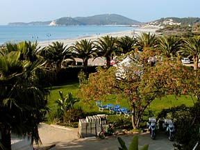
We had to go all the way to Villasimius before we found several hotels open for the season. This was quite acceptable to us as we found a lovely hotel right on the beach and no traffic. At left is a photo of the view from our balcony, complete with the bikes parked under the tree. We walked the kilometer or so into town and bought a gelato before returning to enjoy the view of the sea and coast.
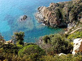
Next we headed north up the east coast, although most of the road is not right on the coast. However, the local road we started on gave us some nice morning views over the Mediterranean. Stopping once, we looked straight down the craggy coast to view the gorgeous crystal blue waters below (above, right). Once we turned inland a bit, we seemed to follow valley after valley, gently rolling through the hills and rarely climbing over 300 feet. Each valley was fertile and green, covered with a variety of plants, from orchards of olives, almonds, lemons and oranges (the scent from the orange blossoms was heavenly), to open fields covered with yellow marguerites and studded with bright red poppies. The roads were in good condition with gentle curves, making a delightful ride.
|
|
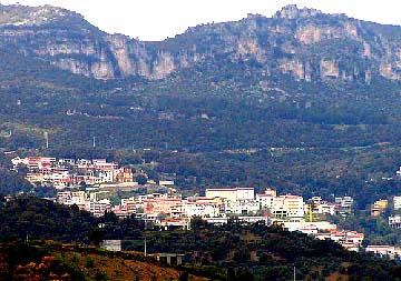
Then about 25 km south of Tortoli, we climbed to 1000 feet and just after the pass came into a quite mountainous area. We rode along the eastern mountain edge, looking over to the large mountains on our left, where we could see several small villages clinging to the hillsides. The picture at left is of Jerzu in the shadow of the rocky crags above.
We had planned to spend the night in Tortoli (we actually found some hotels open, as well as restaurants), but we arrived earlier than we thought we would, so grabbed a quick lunch from the roadside van and hit the road again. With such nice weather and great roads, it is hard to spend time sitting in a restaurant or hotel!
|
|
The road headed inland a bit and started climbing again, until we got to 3400 feet. Just after the pass, a huge valley opened into our view, surrounded by massive granite mountains. Once again, we had to stop for a picture.
 |
The valley was covered with fields and the hillsides terraced with orchards. We found this to be a good example of the variety of fantastic landscapes to be found in Sardinia.
At the northern end of this valley sits the town of Dorgali, after which the road climbs again and we found ourselves riding along the mountain edge, first on one side, then the other. We went around several mountains in this manner, staying at the same elevation, just hugging the contours of the mountains. Of course what one finds in steep rocky mountains are goats and we found them. Coming around a bend, we can see ahead a goat in the road. Slowing, we find ourselves at the local goat crossing, as several goats are climbing up the left bank, cross the road, and continue along on the right. Thankfully, we and the other cars all missed them and they safely got across the road.
The road slowly descends to Orosei and from there to Olbia, it is a easy, gentle ride (although parts of the road seem to be in less than perfect condition). This section of the ride also became quite windy, with gusts pushing us about. Olbia is the main port in the north providing ferry service to mainland Italy and we headed to the ferry port to find out how we to get to Italy. Because it is not high season, the ferry to Italy runs only on the weekends, so we now have several days to explore some more of the north before heading across the Tyrrehenian Sea.
 |
We drove north in the morning, along the coast, enjoying the views of the coast and sea. This area is quite rocky with low shrubby growth. There are many fingers of land jutting into the sea and the elevation is quite varied. It was a gentle easy ride and we soon found ourselves in the midst of Costa Smeralda (Emerald Coast). This area is so named because development along this area of the coast has been carefully controlled (something all countries can take a lesson in doing, in our humble opinion). Although there are many hotels and hundreds of individual villas, all are designed and built with the idea of fitting into the landscape. You will not find any huge high-rise monstrosities nor concrete jungles. It really is quite pleasant as it helps to preserve the nature and views that make the area so desirable. Even the signs for hotels and residence areas tend to be simple large boulders with the name etched and painted onto it. No garish billboards and neon signs here!
 |
|
We found a holiday hotel just north of the area that seemed to suit us (although it wasn’t quite as low-impact as the hotels in Smeralda). We got a one bedroom apartment with small kitchenette for much less than we had paid the night before for just a small room. It is located on a lovely cove (above) near the village of Laconia and provided a nice base for walking about and just relaxing. As we were walking along the beach, we found someone enjoying their day with a sail in the strong breezes.
|
|
|
Well, our last day on Sardinia and it starts with beautiful sunshine and no wind! Wouldn’t you know, we’ve been on Corsica and Sardinia for 3 weeks of stormy and changeable weather. As soon as we are ready to leave, it turns warm and bright! At any rate, we check out of our hotel and find they want to charge an extra 50 Euro for the use of the kitchenette. Well, since they never said anything to us about this when we checked in and nothing was posted in the room, we didn’t want to pay and they had to agree. Whew! Otherwise, that wouldn’t have been much of a bargain. Also, we realized down the road that once again they had forgotten to bill us for the phone calls. This seems to be a universal problem and we try to remember to ask, but sometimes other issues take precedence as we forget as well.
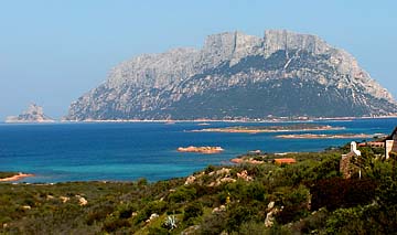
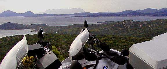
So we turned north to cover the last bit of coast before heading back to Olbia, as we have a ferry booked for tomorrow from Olbia. We enjoyed a great ride through the rocky hills, enjoying the occasional picturesque cove as we rounded a curve. South of Olbia we finally found a hotel that was open (it took us several tries to find an open hotel), offering us a quiet room in the country, overlooking the bay. There is a huge lump of rock just off the coast, somewhat reminiscent of Gibraltar (above, left).
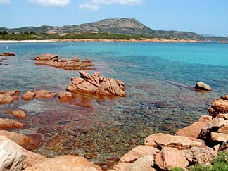
With the nice weather, the bay was calm and looking very inviting. Near the hotel there was a small port with small motor boats and several beaches, some sandy, some partly rocky and partly sandy. The water is incredibly clear and the most gorgeous shades of turquoise and aqua. There are many holiday homes in the area and it looks like it would be a nice area to just relax and enjoy the peace and quiet.
We went to a nearby village to get some lunch and decided to opt for a restaurant instead of our usual pizzeria. Well, the food was absolutely delicious. We ordered ravioli, swordfish, and grilled vegetables and ate like royalty. Now, we don’t think we were doing things “right” as we ordered just one dish of each, then proceeded to share each one. However, it was just the right amount of food for us. We can’t imagine each one of us ordering a full meal (either in terms of eating all of it, or paying for it). While good food is easy to come by, it certainly isn’t inexpensive in our book.
This concludes our adventures in Sardinia. Next stop, mainland Italy!
|

