 |
|||
|
When the U.S,. purchased the French enterprise they tried negotiating with Columbia to acquire the rights to build the canal but a deadlock ensued. President Teddy Roosevelt was determined to have the canal site and aided in producing a revolution in the area. The U.S. quickly recognized the Republic of Panama and signed a treaty giving the U.S. the desired strip of land for $10 million and $250,00.00 a year. In exchange for U.S. protection the Panamanian government gave the U.S. control “in perpetuity” of a 10 mile wide zone for the proposed canal.
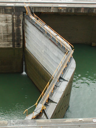
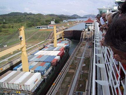
Six locks (three on each coast) are necessary to lift and lower ships through the entire canal. Each lock is paired for double lane, side by side simultaneous passage of two ships. There is a channel off to the right of the canal’s east entrance which is the beginning of the unsuccessful French effort to cut a waterway between the two oceans.The Gatun Locks on the Caribbean side of the Continental Divide (below left) raise the ship in three lock steps a total of Once it is raised to the level of the lake and towed out of the third lock, ships resume course under their own power for the trip into Gatun Lake. To reach the Pacific Ocean ships move through the narrow nine mile long Gaillard Cut (below) to the west end of the canal where the vessels are towed through the Pedro Miguel and Miraflores Locks, which lower the ships the necessary 85 feet to the level of the Pacific Ocean. The Panama Canal locks were the largest structures of their kind ever built. Each lock is 1,000 feet long and 110 feet wide. The deepest ship’s draft permitted is 40 feet. The lock doors are made of riveted steel, 65 feet wide, seven feet thick, and range from 47 to 82 feet high, depending on their position in the canal. Due to the strong high tides of the Pacific Ocean, the doors in the Miraflores Lock are the largest and heaviest, weighing over 745 tons. Lock gates are hollow, or compartmentalized, so they virtually float, and their balance is such that only a 40 horsepower motor is needed to open and close them. Over 1,500 electric motors are used in the various operations of all the locks. However, no pump are used to fill or empty them. Instead, water is moved by It takes over 26 million gallons of water from Gatun Lake to fill the locks and raise a ship through the three levels of the Gatun Locks. Considering the vast daily rainfall in Panama, there is no danger of a shortage, or waste, of water. Due to Panama’s unique geography, there are places in the country where the sun rises over the Pacific and sets in the Caribbean. Ships heading from the Caribbean to the Pacific must travel east! On the map of Panama on the first page of this section, you can see that the country forms an “S” shape, and is situated between the Caribbean and the Pacific in such a manner that the Cristobal entrance to the canal on the Caribbean side is actually 23 miles WEST of the Panama City entrance on the Pacific side.
Therefore ships traversing the canal westward from the Caribbean to the Pacific actually travel in a southeast direction while ships heading east from the Pacific to the Caribbean go in a northwest direction. |
|||
|
If you find typographical errors or have any other problems when looking at the site please contact the Webmaster describing the problem and the page involved. |
|||
|
Copyright © 2000-2009 Jim Seavey and Verna Norris All Rights Reserved |
|||
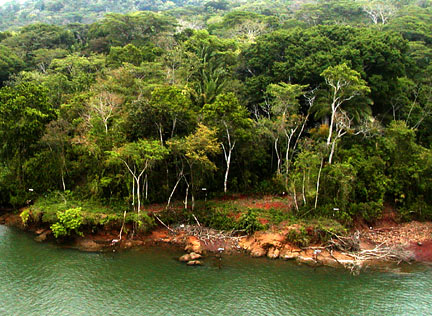 The French hoped to build a sea level canal as had been done in Suez. After 24 years of work with less than 10 miles of the 30 mile project completed the disillusioned and bankrupt French sold the enterprise to the U.S. Government for $40 million - much less than the $300 million they had invested and now lost.
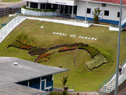 Work started by the Americans in 1905 with no firm plan in place. In order to tame the wild Charges river the largest dam ever built was erected to form a lake that would serve as a reservoir for use in the soon to be constructed locks. Gatun Dam is a mile and a half long and is 85 feet above sea level. The reservoir, Gatun Lake, is one of the largest man made bodies of water in the world covering more than 160 miles and forming almost half - 23 miles - of the Panama Canal.
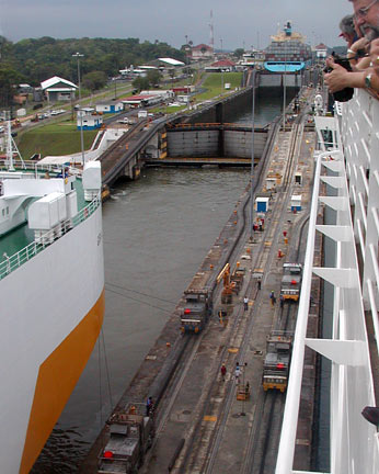 85 feet up to the level of Gatun Lake. Ships are pulled into and through the 1.6 mile long locks by cables attached to mechanical “mules” on tracks alongside. Panamanian pilots board the ship to oversee the entire process. Ships are not under their own power through the narrow locks.
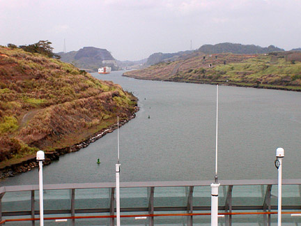 gravity, flowing from level to another. When the water level in one lock step equals that in the next step, the gates between them are opened and the ship is towed forward. In multiple lock steps such as the Gatun, the gates are closed again and the process repeated.